01628 436 494
Thames Valley Drones

Drones In Garden and Landscape Design


The use of drones in garden and landscape design are changing how professionals work across the industry. From initial site surveys through to final documentation, this technology is making the entire process faster, more accurate, and more cost-effective.

Drones In Garden and Landscape Design

What once took a two-person team six hours to survey can now be completed by one person in just 15 minutes, with greater precision and no risk of human error. This means garden designers, landscape architects, and contractors can deliver more accurate, site-specific designs while saving significant time and money for everyone involved.

Streamlining the Garden Design and Landscaping Process

Drones have become an increasingly popular and essential tool across various industries, with garden design and landscaping being among the key sectors benefiting from this technology. They serve as a crucial instrument that helps save both time and money by streamlining the entire surveying and planning process, as well as bringing garden design and landscape plans to life with unprecedented accuracy and detail.

Drones in garden and landscape design are also invaluable for returning to a site after the project has been completed. This capability allows designers, landscape contractors, and clients to obtain a clear, comprehensive view of the entire garden space and its development from an elevated perspective, ensuring that everything that was designed and planned has been properly executed and come to fruition. Before, during, and after photography captured by drones serve as valuable visual records of the project’s complete journey for designer, contractor, and client alike.


Accurate Drone Surveying and Site Mapping

The efficiency gains when using drones in garden and landscape design for site surveying are remarkable. A manual site or garden survey can take up to six hours without drone technology, requiring two people to complete the task and leaving plenty of room for human error in measurements and site assessment. In stark contrast, a drone can map out and survey a site in just 15 minutes with just one person operating the equipment, completely eliminating human error from the measurement process.

Garden designers and landscape professionals can now deliver true-to-life plans for garden design, landscaping, and irrigation projects. This enhanced accuracy allows clients to properly visualise the final design in the context of their actual site, and enables the designer or contractor to produce far more accurate costings and quotations. The entire process from initial survey through to final design presentation is significantly sped up, improving both efficiency and client satisfaction.

Enhanced Visualisation Through Drone Imagery

Drone images and aerial photography provide a realistic, immersive experience that transforms the design process. The comprehensive aerial imagery allows the designer, landscaper, contractor, or client to virtually revisit the site at any point during the design and planning process, and from wherever they are in the world. This flexibility is particularly valuable for clients who may be travelling or working remotely, or for designers collaborating on projects from different locations.

The use of professional drone imagery also ensures a more site-specific, tailored design that accurately meets the client’s personal requirements and site constraints. High-quality aerial photographs and video can significantly increase client engagement and buy-in to the proposed design, as they can see exactly how the landscape design will work within their actual space and existing context.

Planning Around Existing Site Features

Another significant advantage of using drone images for garden or landscape design projects is the ability to more easily and accurately plan around existing features on the site. This includes mature trees, established hedges, outbuildings, and existing structures that need to be carefully considered in terms of available space, root protection areas, and property boundaries. Aerial drone surveying provides precise measurements and visual context that would be difficult or time-consuming to capture from ground level.

Drone photography also shows the garden or landscape site in its wider setting and surrounding context, enabling clear views of the designed space and the important borrowed views and vistas from beyond the boundary. This is especially valuable when designing elevated spaces like balconies or roof terraces, or even when planning spaces that haven’t yet been built but need to be visualised in relation to existing or proposed structures.

Precision Irrigation Mapping and Planning

Beyond general time and cost savings, drones in garden and landscape design have specific and highly valuable uses in irrigation system mapping and planning. By taking a comprehensive drone shot and aerial survey of a large site, landscape contractors and irrigation specialists can accurately measure and plot the optimal placement of irrigation systems, sprinkler heads, and the specific areas they will cover.

In wet weather conditions, aerial drone imagery makes it considerably easier to spot areas where water is pooling or where there are changes in soil composition and ground levels that affect drainage. This detailed site analysis can allow for precise coverage planning of the garden irrigation system down to the millimetre. While irrigation coverage can certainly be calculated without drone technology, aerial surveying significantly improves accuracy, reduces the margin for error, and makes it much easier for clients to understand and engage with the technical aspects of the irrigation design.

Property Showcase and Marketing

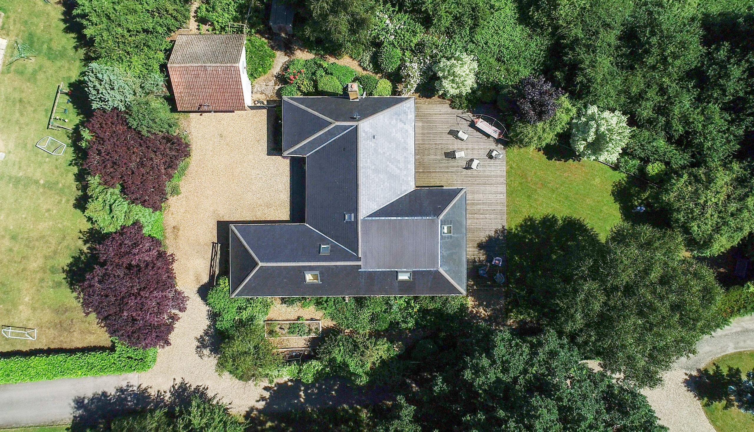
Drones in garden and landscape design aren’t just tools for the planning and construction phases. For the proud property owner or sales agent, professional aerial photography and videography are a wonderful way to show a property and its landscaped gardens at their very best. Stunning aerial footage serves as the ideal gift for the person whose house and garden are their pride and joy, or as exceptional marketing material for properties being brought to market.

The dramatic perspectives and comprehensive views that drone photography provides can showcase the full extent and beauty of landscape design work in ways that traditional ground-level photography simply cannot achieve.

Our Services

Based in the Thames Valley, we provide specialist drone services across Berkshire, Oxfordshire, Surrey, Sussex, Northamptonshire, Hampshire, Buckinghamshire, and Warwickshire.

Our comprehensive range of services includes land surveying and mapping, 2D mapping and 3D modelling for photogrammetry and orthomosaics, aerial photography and videography, drone roof inspections, aerial building inspections, and aerial site surveys. We also provide drone property photography and landscape photography for campaigns and archives, ensuring your garden and landscape projects are documented and showcased at their very best.

Ready to Transform Your Garden Design Projects?

Whether you’re a garden designer looking to streamline your surveying process, a landscape contractor needing accurate site mapping for irrigation planning, or a property owner wanting to showcase your garden at its very best, Thames Valley Drones can help you harness the power of drones in garden and landscape design to bring your projects to life.

Get in touch today to discuss how our specialist drone services can save you time, reduce costs, and deliver exceptional results for your garden and landscape design projects. Contact Thames Valley Drones to arrange a consultation or request a quote for your next project.