01628 436 494
Thames Valley Drones

Residential Drone Roof Inspections

Thames Valley Drones provide residential drone roof inspections across the Thames Valley and nearby counties, capturing high-quality roof imagery from multiple angles to show condition, structure, and hard-to-reach details. Each inspection is planned around the property, local conditions, and any specific areas you want to check, with sensible launch and recovery points chosen to minimise disruption around the property. Images are supplied in an organised format that’s easy to review and reference, with the option for marked-up images, issue keys, and image keys to speed up follow-up and sharing.

Get In Touch
Residential Drone Roof Inspections

What residential drone roof inspections are for

Most homeowners book a drone roof inspection when they want a clearer view before deciding what to do next. It can help when you’ve noticed or suspect a problem, when you want reassurance after bad weather, when buying or selling a property, or when access is awkward.

A drone view is useful because it can show the overall roof as well as close-up detail. That makes it easier to precisely understand what’s going on across the whole roof, not just what can be seen from ground level.

What we do

For residential drone roof inspections, Thames Valley Drones start by confirming what you want to check, and which areas matter most to ensure we have this covered, however will still inspect the whole roof (unless specifically instructed or if the roof is shared across a number of terraced properties for example) and provide a single bird’s eye view of the whole roof. Just because an issue seems to be manifesting itself in one location, this does not mean this is where the issue arises. Particularly with water ingress and leaks, water will find the route of least resistance and this will include slopes (gravity), conduits like pipes as well as proud roof fabrics.

We then plan around the property and local conditions. This includes access, vulnerable neighbours (schools or care homes), and nearby hazards such as roads, car parks, trees, and overhead lines. Where required, we obtain permissions, and choose sensible launch and recovery points to minimise disruption to your household.

From the air we capture high-quality imagery from multiple angles. This includes wider context, oblique views of elevations, and close-ups of roof features such as chimneys, tiles, ridges and valleys, parapets, rooflights, lead flashing, gutters and downpipes, vents, and solar panels. Where roofs are complex or multi-level, we work methodically so results are consistent and easy to compare.

Making the images easy to use

Homeowners often need to share roof images with someone else, for example a roofer, builder, or insurer. To make that easier, Thames Valley Drones organise the images so they’re simple to review and straightforward to reference.

If you want to speed up the follow-up process, we can also supply marked-up images alongside the original images and clearly laid out in organised image folders. Marked-up images are the same roof photos, with clear labels added to show the agreed areas of interest.

An issue key is a simple list that explains what each label refers to, so it’s easy to point to the same spot when you’re discussing the roof. An image key is a simple way of naming viewpoints, so you can quickly find the right angle during review, or when the same roof is inspected again.

How we plan your survey

Each survey is planned around your requirements, your objectives, and the property itself. Together we confirm the survey area, priority points, and any specific viewpoints you need. Where relevant, Thames Valley Drones can liaise with owners, managers, neighbours, or tenants on-site, and choose practical launch and recovery points to keep things running smoothly and safely.

Where this helps

Residential roof inspections are useful for pitched and flat roofs, complex roofscapes, delicate building fabrics, and homes with limited access. They support routine maintenance, defect checks, and proactive or reactive investigations.

Common triggers include reports of leaks or fallen tiles, causes can include blocked gutters, slipped or broken tiles, damaged membranes, cracked pointing, vegetation on roofs, resulting in signs of water ingress.

For insurance matters, aerial views can provide clear visual evidence of storm impacts such as fallen branches, displaced flashing, and impact points, helping to show the extent and location of issues. Drone-based aerial photography can also shed light on the potential lines of boundaries where a dispute has arisen.

Where we work

Residential drone roof inspections are carried out across the Thames Valley and nearby counties, including Berkshire, Buckinghamshire, Essex, Gloucestershire, Hampshire, Kent, Northamptonshire, Oxfordshire, Surrey, Sussex, and Warwickshire.

Regular towns that Thames Valley Drones work in and around include Reading, Slough, High Wycombe, Marlow, Basingstoke, Oxford, Banbury, Guildford, Brighton, Chichester, Crawley, Horsham, and Warwick.

Want to get in touch with Thames Valley Drones?

Tell Thames Valley Drones about your site and what you need to see, and we’ll plan a practical residential drone roof inspection and capture clear, organised imagery.

Why choose Thames Valley Drones for residential drone roof inspections

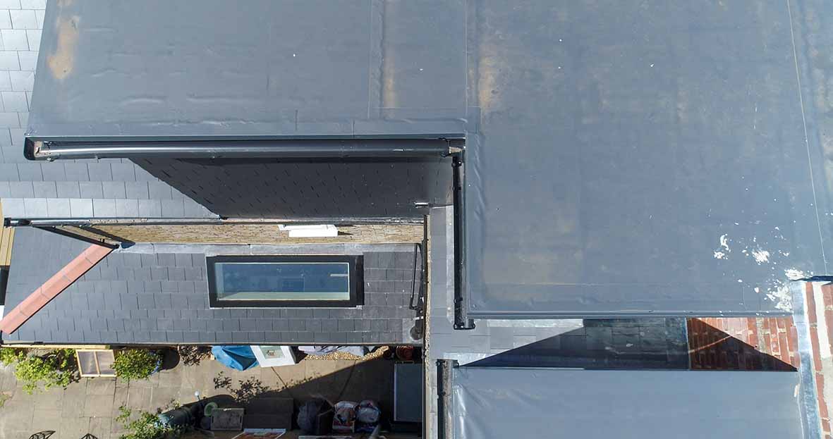
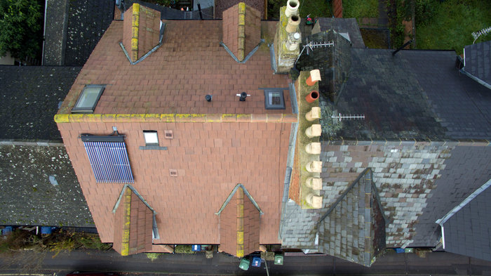
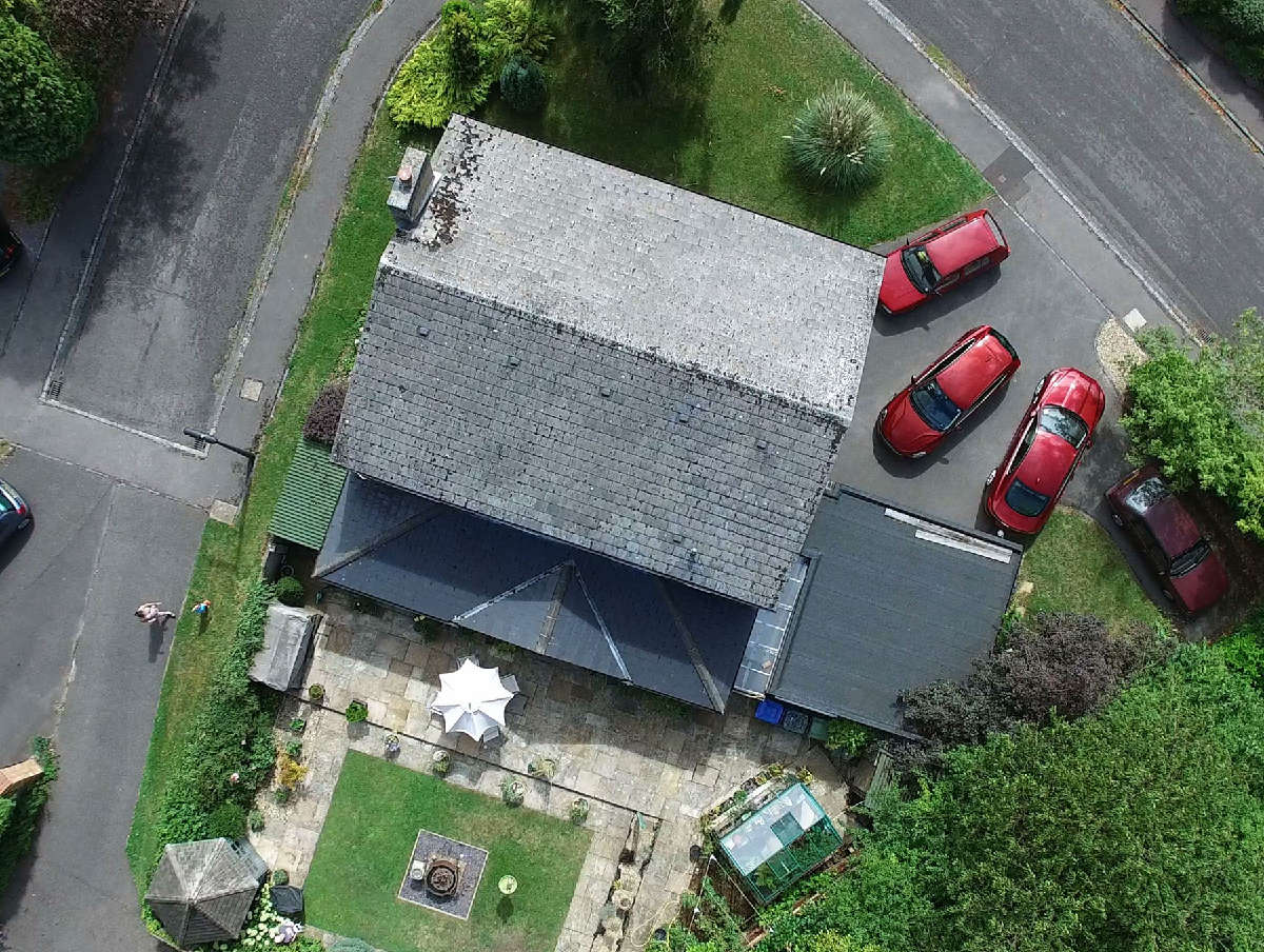
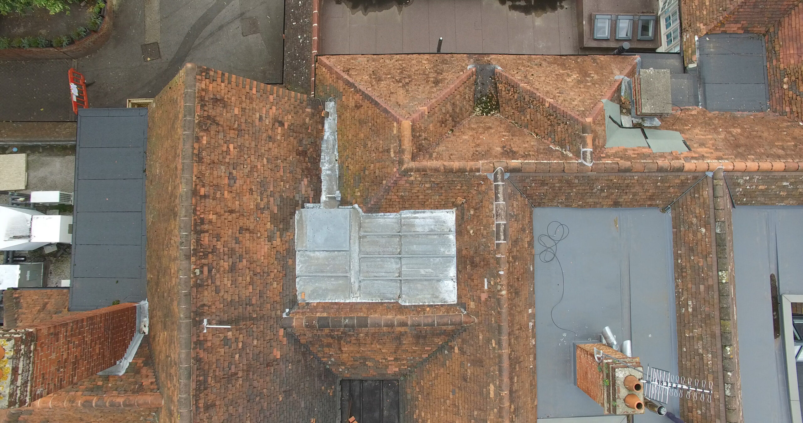
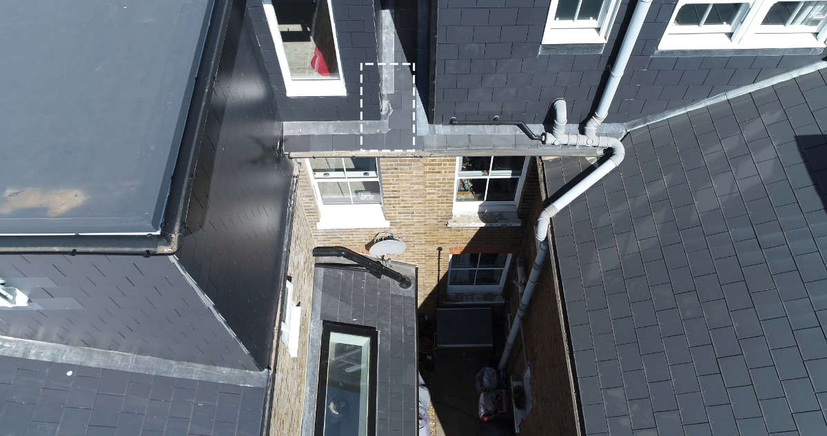
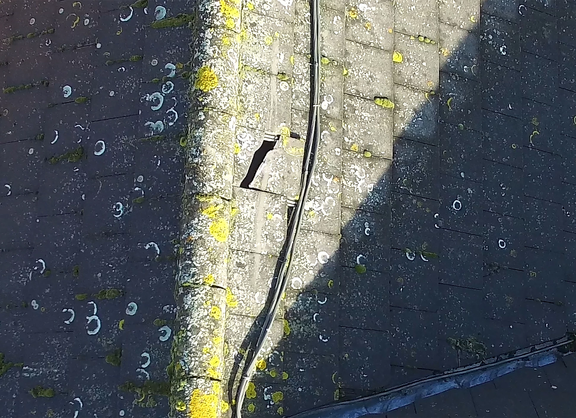
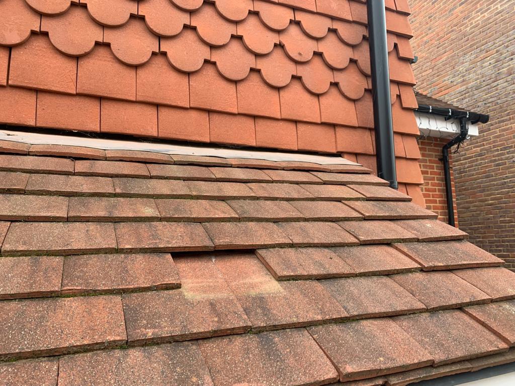
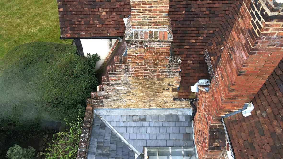
Thames Valley Drones focuses on making high quality roof inspections safe, practical, and cost efficient no matter the size of your roof. A drone inspection can provide a more suitable means of ascertaining a residential roof’s condition with a faster, more accurate and less intrusive process. With a drone roof inspection, it provides unparalleled access to all areas of the roof including areas behind a chimney stack on a sloped roof.

Drone roof inspections also reduces the need for working at height, reduces the need for costly and cumbersome scaffolding, or even elevation platforms, that may not be able to get a close view of vital areas of the roof, those beyond its reach, especially  if there is no way to get access equipment easily to the back or side of the housem if atall.  All this may prevent a home securing the information they really need about the condition of their roof or any potential issues looming.  

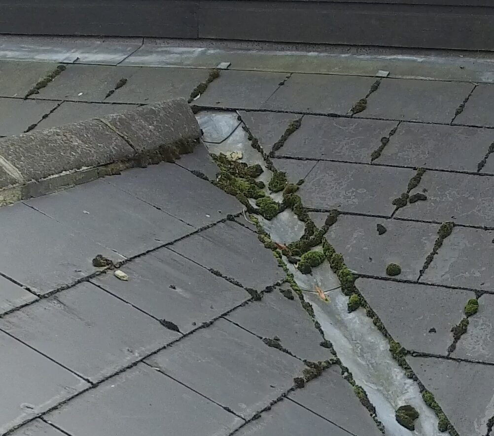
High quality aerial photography of every aspect of a roof can help keep any (potentially) wayward contractors honest by giving you a clear picture of precisely what is going on  with your roof .  Plus before and after photography, available at a reduced price once we have flown your roof, can also ensure work is carried out to the specified quality and ensure further damage isn’t done while remedial repairs are carried out by contractors while on your roof.Scheduling is straightforward and flexible around live sites, and a Thames Valley base means nearby counties can be covered efficiently.

Who else we work with

Thames Valley Drones also works with organisations responsible for buildings and sites across the Thames Valley and the South East.

  • Surveyors: roof context and feature detail to inform condition and dilapidation reports, tender packs, and planned maintenance schedules

  • Facilities and estates teams: confirm priorities before committing to access equipment or opening up interiors

  • Insurers and loss adjusters: record relevant areas so locations can be identified quickly during follow-up

  • Architects: clear aerial views to support planning and documentation

  • Roofing contractors: visuals that help plan access and follow-on work

  • Property managers: quick clarity across multi-building sites and repeat inspections

  • Construction firms: roof and perimeter context to support site work and next steps

  • Housing providers, schools, colleges, healthcare sites, care homes, retail parks, industrial estates, offices, and heritage properties: clear visuals that support decisions and next steps

Our other drone services

Alongside residential roof inspections, Thames Valley Drones offer commercial drone roof inspections, aerial photography and videography for marketing and documentation. Land surveying, 2D mapping, and 3D modelling provide clear site context for planning or wayfinding and contractor familiarisation. Thames Valley Drones also carry out aerial building inspections and aerial site surveys to assess conditions faster and plan safe, cost-efficient access. Drone property photography and landscape photography are also available, so you can brief teams and share updates with confidence, we also provide ground, exterior and interior photography.

How to get started

Once commissioned, this is the sort of information Thames Valley Drones will need: the property address, roof type, and what you need to see, along with any access constraints or nearby hazards. Share preferred dates, and any live-site considerations. If this relates to an insurance claim, include any previous images, plans, or reports. If you’d like marked-up outputs, say how you want items referenced (issue key, image key, or both), and any terminology you want used.