01628 436 494
Thames Valley Drones

Aerial Photography for Land Surveyors

Land surveyors come to us when they need accurate aerial data and imagery that their existing ground-based methods cannot easily provide. Aerial photography for land surveyors is something we deal with regularly, from straightforward site photography through to photogrammetry, 2D mapping, and 3D modelling.

Get in touch
Aerial Photography for Land Surveyors

Aerial photography for land surveyors sounds straightforward until you look at what is actually involved in doing it commercially. In the UK, flying a drone for paid work is not something you can just pick up and do. You need proper qualifications, Civil Aviation Authority registration and authorisation, public liability insurance, and ongoing flight planning and risk assessments for every job. That is before you factor in buying and maintaining the equipment, keeping up with CAA regulatory changes, and learning the processing software that turns raw aerial data into usable survey outputs. Regulations change, equipment needs updating, and software requires ongoing investment. For most surveying practices, that overhead simply does not make sense alongside everything else you are managing.

Fitting Into Your Workflow

We understand that land surveyors often work to tight project timescales and need outputs in formats that work with their existing software. Before every flight we talk through what you need, how you intend to use the data, and what file formats work best for your workflow. We can discuss coordinate systems, ground control point requirements, and output resolution at the planning stage so there are no surprises when you receive the data.

If you need the same site covered again at a later stage of a project, we keep records of our flight parameters so subsequent visits produce consistent, comparable outputs.

Why Work With Thames Valley Drones

Bringing in Thames Valley Drones means the aerial side of your project is handled by people who do this every day. You are not waiting on a colleague to find time to fly, dealing with equipment that needs repair, or worrying about whether your insurance covers a commercial operation. You call us, we plan the flight, we turn up, and you get organised data back that is ready to use. If regulations change or a site throws up something complicated, that is our problem to solve, not yours.

Our pilots hold the CAA’s A2 Certificate of Competency, allowing safe and legal aerial operations in built-up, residential, and commercial areas that would otherwise be restricted or require special permission for larger drones. Having been trained to GVC PDRA-01 standards, we operate to the highest levels of safety and expertise. We carry full public liability insurance and hold CITB CSCS accreditation for construction site work. Every flight comes with a method statement and risk assessment prepared for the specific site.

You get the data. We deal with everything else.

Who Else We Work With

As well as offering aerial photography for land surveyors, Thames Valley Drones works with property managers, architects, developers, roofing contractors, estate agents, and construction companies at all stages of a project. Our services include aerial building inspections, drone roof inspections, aerial site surveys and progress monitoring, property and landscape photography, land surveying and mapping, and 2D mapping with 3D modelling. If your project involves a combination of these, we plan the flight to cover everything in one visit rather than coordinating multiple trips to site.

Where We Cover

Thames Valley Drones operates across Berkshire, Buckinghamshire, Oxfordshire, Hampshire, Surrey, Sussex, Warwickshire, and Northamptonshire. If your survey work takes you across multiple counties or you manage a programme of sites, we can coordinate visits around your project schedule to keep things straightforward.

Aerial Photography for Land Surveyors

If you have a project coming up and want to talk through what drone data could do for it, give us a call or drop us an email. We are easy to deal with and happy to discuss what is possible before you commit to anything.

What We Can Deliver for Land Surveyors

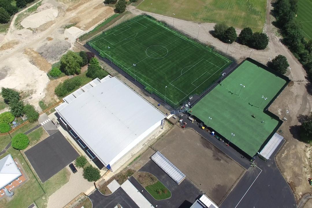
Photography and Site Coverage

Large sites, awkward terrain, access restrictions, and built-up boundaries all become easier to document from the air. We can photograph the full extent of a site in a single visit, capturing boundary lines, level changes, vegetation, structures, drainage features, watercourses, and surrounding context in a way that ground photography cannot match. Images are delivered with clear file names and logical organisation, ready to slot into your reports and client packs.

Photogrammetry, 2D Mapping and 3D Modelling

When you need more than photographs, we extend the flight to include photogrammetry. This produces georeferenced 2D orthomosaic maps you can measure from directly, 3D surface models useful for volume calculations and cut-and-fill assessments, and Digital Surface Models that complement your ground-level survey data. Because everything comes from the same flight, it all aligns properly with no reconciliation needed between different data sources.

Topographic Survey Support and Boundary Imagery

Aerial data works well alongside traditional total station and GPS survey methods, filling in the wider picture quickly while your team focuses on detail work that requires direct measurement. For boundary disputes or title queries, dated aerial photographs showing hedges, fences, walls, and access points provide clear supporting evidence that clients and solicitors can understand without needing to interpret technical survey drawings.

Structure Inspections Within Survey Areas

If a site includes existing buildings or infrastructure, we can document roofs, facades, retaining walls, and other elevated features as part of the same visit, without the need for scaffolding or access equipment.

Frequently Asked Questions

Do I need to provide ground control points for photogrammetry work?

Ground control points improve the absolute accuracy of photogrammetric outputs, particularly for survey-grade work. We discuss this at the planning stage and can advise on placement and quantity based on your accuracy requirements.

What accuracy can I expect from drone photogrammetry?

For most survey applications, drone photogrammetry can achieve horizontal and vertical accuracies in the range of a few centimetres when ground control points are used. We are happy to discuss the specifics of your project before committing to a flight.

What file formats do you deliver data in?

We can deliver orthomosaics as GeoTIFFs, point clouds in LAS or LAZ format, 3D mesh models, and Digital Surface Models in formats compatible with standard survey and GIS software. If you need a specific output, let us know at the start and we will make sure the data works for you.

Do you work on live construction sites?

Yes. We hold CITB CSCS accreditation for work on live construction sites, so if your survey involves an active development, we can attend site safely and in compliance with site requirements.

Can you return to the same site for repeat surveys?

Yes. We keep records of flight parameters and camera positions from every job, so repeat visits produce consistent, comparable data. This is useful for monitoring progress or capturing conditions at different stages of a project.