01628 436 494
Thames Valley Drones

Aerial Photography for Construction Firms

Showing construction progress is straightforward when you can see the whole site at once. Thames Valley Drones provides aerial photography for construction firms, planned flights that capture layout, access, and work fronts from above, with files organised for your reports and meetings.

Aerial Photography for Construction Firms

See Your Whole Site at Once

Aerial images show how everything fits together. One overhead shot can capture crane positions, material storage, access routes, scaffolding, and active work fronts all in the same frame. Providing aerial photography for construction firms will give your team, your clients, and your stakeholders a shared view of exactly where things stand. When everyone can see the same picture, conversations become clearer and decisions happen faster.

Build a Visual Record as You Go

Regular aerial capture from consistent viewpoints creates a timeline of your project from start to finish. These images become a valuable archive that you can reference for progress reports, milestone documentation, and project reviews. When you can show what was happening on site at specific dates, it strengthens your records and supports clear communication with everyone involved. Using aerial photography for construction firms gives you visual evidence that complements your written documentation.

Keep Clients and Stakeholders Informed

Monthly progress meetings run smoothly when everyone can see what’s been achieved. Aerial images show how Phase 2 is progressing, where temporary works currently sit, and how the site layout is developing. For developers reporting to investors, or main contractors updating client representatives, clear overhead views communicate progress efficiently and build confidence in the project.

We Understand Live Construction Sites

Our pilots hold CSCS Health, Safety and Environment accreditation, which makes getting us through your site induction straightforward. We’ve worked alongside main contractors, housing developers, and civil engineering teams across the Thames Valley and beyond. We plan flights around your operations, agreeing launch areas that work with your site layout, timing capture to suit your programme, and coordinating with your site manager so everything runs smoothly.

What a Typical Visit Looks Like

Before we arrive, we review your brief and carry out a desk-based assessment of the site. We look at access, boundaries, nearby features, airspace considerations, and any coordination needed with neighbours. We produce a method statement and risk assessment specific to your project. On the day, we agree the final flight plan with your site team, set up in a suitable location, and capture what’s needed. Most flights take around 20 minutes in the air. You receive images within days, named and organised so they’re easy to find whenever you need them.

Measurement and Mapping When You Need It

When your project calls for survey data alongside photography, we can capture information for 2D mapping, surface models, and 3D site models during the same flight. This gives you accurate visual references you can measure from directly, useful for earthworks volumes, level checks, or coordinating with design consultants. Using professional aerial photography for construction firms as well as survey data will complement each other well when they’re planned together, and combining them in one visit keeps everything aligned.

Want to get in touch with Thames Valley Drones?

Get in touch to discuss your project. We provide professional aerial photography for construction firms and can work around your site operations.

Useful Throughout Your Project

Before breaking ground: Record existing conditions for baseline surveys and pre-commencement documentation.

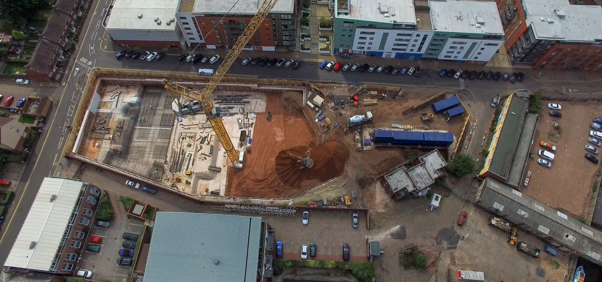
During construction: Track progress phases, document logistics layouts, monitor temporary works, and create visual records for programme reviews.

At key milestones: Capture completion of major elements for sign-off documentation and client reporting.

For health and safety: Document site setup, pedestrian routes, welfare arrangements, and overall site organisation from a clear vantage point.

At handover: Record the finished works and their setting for project close-out and ongoing records.

Professional Results With Full Accreditation

We hold full CAA operational authorisation, carry up to £10m third party liability insurance, and our pilots are trained to the latest GVC standards. For construction firms, bringing in a specialist means you get professional aerial capture that meets all regulatory requirements, while your team stays focused on building. We handle the flight planning, permissions, and safety documentation so you can concentrate on your project.

Your Files, Organised and Ready to Use

We name files clearly, link them to flight plans and dates, and group them logically. Wide orientation shots sit alongside related detail images from the same visit. When you need to find an image from months ago, it’s easy to locate. Aerial photography for construction firms delivers the most value when images are organised and accessible, so that’s how we set things up from the start.

Other Ways We Can Help

Alongside aerial photography, we offer drone roof inspections, aerial building inspections, land surveying and mapping, aerial site surveys and inspections, property and landscape photography, and 2D mapping with 3D modelling. For construction clients running multiple services on one project, we design flight plans that serve each purpose efficiently. One site visit can deliver progress photos, survey data, and inspection images, all coordinated to make the most of your time.

Where We Work

We cover Berkshire, Buckinghamshire, Oxfordshire, Hampshire, Surrey, Sussex, and Warwickshire as well as Northamptonshire. Common locations include Reading, Slough, High Wycombe, Basingstoke, Oxford, Banbury, Guildford, Brighton, Crawley, and Warwick. If you’re running multiple sites across the region, we can coordinate a programme of visits that fits your schedule.