01628 436 494
Thames Valley Drones

Aerial Photography for Architects

Clear visuals make decisions easier. We provide aerial photography for architects to show context, access, and roof-level detail in one view, so feasibility checks and planning conversations are straightforward. We provide planned flights to your brief and we offer organised files you can drop straight into drawings and reports.

Get in touch
Aerial Photography for Architects

Why Architects Use a Drone

Aerial images show the whole setting in one view. From a single elevated frame, you can read how a plot sits within its surroundings, where access points lie, and how features relate spatially. This helps at feasibility when you are assessing constraints and opportunities, and later when you are explaining proposals to clients, neighbours, and stakeholders in plain visuals. Used through a project, aerial photography for architects supports team communication by recording conditions at set intervals. Repeatable viewpoints build a visual record you can reference at reviews and design meetings.

What We Capture

We cover the scene with wide orientation shots, then add targeted context views and closer detail where needed. Roof coverings, chimneys, parapets, rooflights, plant areas, entrances, service yards, and junctions are recorded in clear imagery that helps you plan next steps. When a brief calls for both overview and detail, we plan vantage points that work together, so an orientation frame sits naturally alongside tighter views of a façade or junction. This is where aerial photography for architects is effective, because one visit can produce a coherent sequence from context to detail.

How We Plan and Fly

Every project starts with your brief. We review access routes, pedestrian activity, nearby roads, treelines, and overhead lines. Where required, we arrange permissions with owners or site managers. Launch and recovery points are chosen to suit the location and reduce disruption. Each flight follows a method statement and a site-specific risk assessment. Because viewpoints are planned, we can return to the same positions on later visits, making comparisons straightforward as a scheme progresses.

When It Helps Most

At feasibility, aerial photography for architects shows plot shape, neighbouring massing, landscape structure, and key links such as footways, service routes, and public spaces. During concept and developed design, consistent aerials support massing studies and visibility checks, with clean overheads and obliques that drop straight into option packs. For planning, well-chosen images explain setting clearly, so readers understand approach, scale, and relationships at a glance. On existing buildings, elevated imagery supports condition checks without working at height, helping you review parapets, gutters, plant screens, interfaces, and tight courtyards with less disruption.

Why Use an External Partner

For many studios, it is simpler to use an external company than to buy and run a drone in-house. Safe, responsible flying needs planning, site checks, and ongoing upkeep. Training, maintenance, and data management add cost and time. By asking us to fly for you, you avoid that overhead and keep focus on design and coordination, while still getting images aligned to a clear brief.

Measurement Options When Needed

When measurement is required alongside imagery, we align the flight plan with a photogrammetry workflow. From the same access window, we generate map-accurate orthomosaics, digital surface models, and textured meshes in CAD or GIS-friendly formats. The benefit is a dependable visual reference for form, levels, and surroundings that you can measure from directly. Photographs and mapping match because they are planned together, which reduces assumptions and supports coordination with consultants.

Want to get in touch with Thames Valley Drones?

Providing quality and accurate aerial photography for architects and other industries.

Working on Live Sites

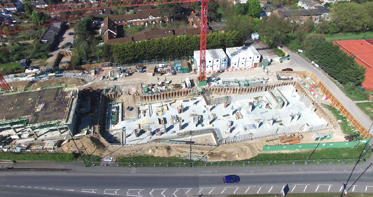
Many projects take place in busy environments. We plan around site operations and public routes, agree sensible launch areas, and time capture for suitable light and weather. Where buildings are complex, we agree a compact list of consistent viewpoints so the same angles can be revisited later without confusion. This makes aerial photography for architects a practical fit for estates, campuses, heritage settings, and multi-building sites where periodic updates help teams stay aligned.

How We Organise Results

Projects often run for months. You may need to revisit imagery long after capture. We name and group files so they are simple to find, with clear links back to the flight plan and viewpoints. Orientation frames sit with related context and detail images. If mapping outputs are included, they sit alongside photographs from the same visit. The aim is straightforward. Keep your time focused on design and coordination, not on chasing assets.

Related Services

We also provide drone roof and aerial building inspections, aerial site surveys, land surveying and mapping, 2D mapping, and 3D modelling. When a project needs both photography and mapping, we design the flight plan to serve each purpose. Orientation frames match the orthomosaic, and obliques align with model extents. The result is consistent material that fits neatly in your workflow and can be reused across stages without re-explaining context.

Areas We Cover

Our operations cover Surrey and extend into Berkshire, Buckinghamshire, Essex, Gloucestershire, Hampshire, Kent, Northamptonshire, Oxfordshire, Sussex, and Warwickshire. Multi-site projects can be coordinated to suit your programme.