01628 436 494
Thames Valley Drones

Drone Roof Surveys Using Photogrammetry

Here at Thames Valley Drones, we often get asked about drone roof inspections and drone roof surveys. While the terms are often used interchangeably, there are some key differences between the two.
The main difference lies in the process, the results, and of course, the cost.
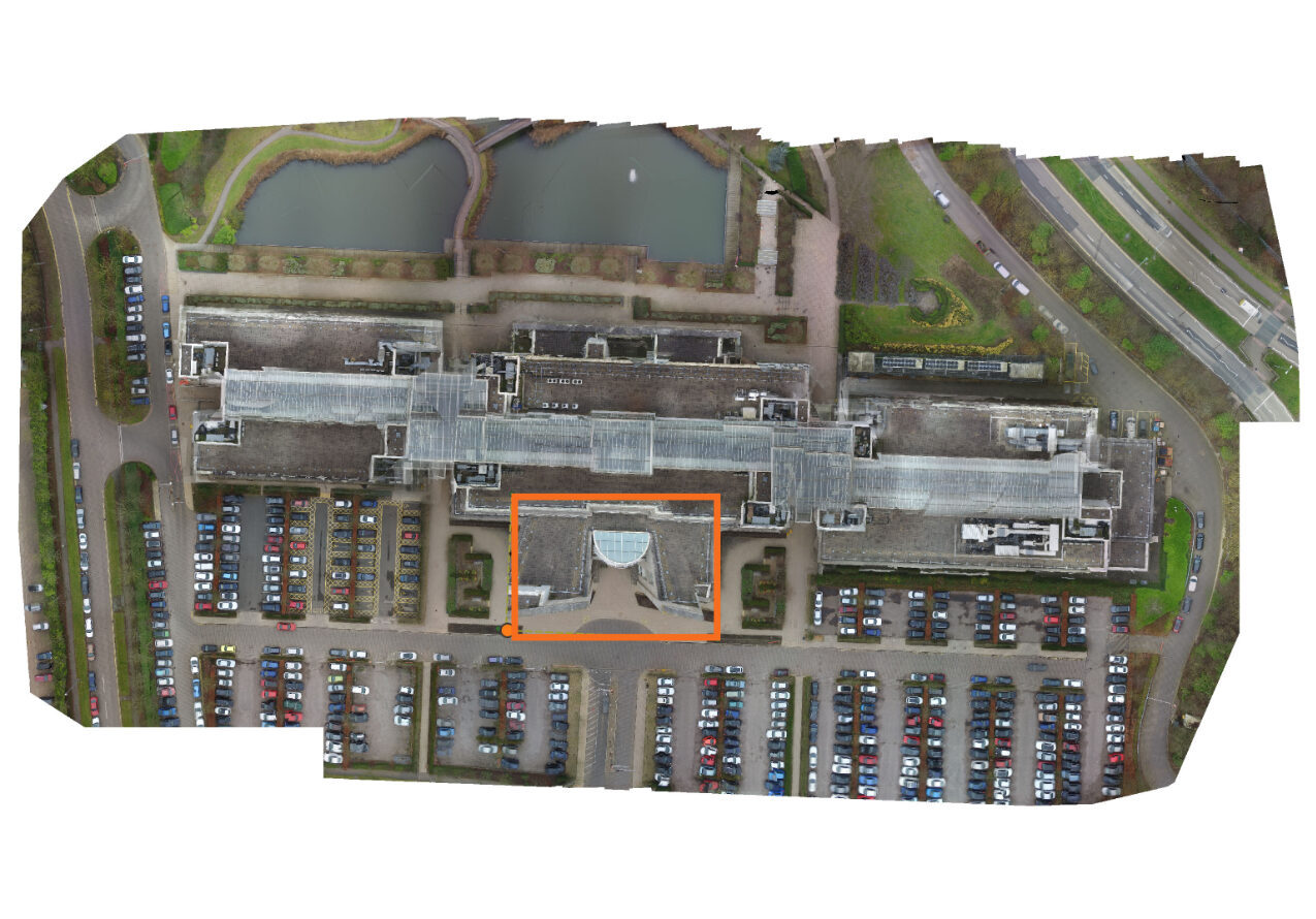
Usually, the biggest factors that decide if you need a drone roof survey as opposed to a drone roof inspection are the size of your roof and how you plan to use the images or data.
A drone roof survey goes way beyond a simpler drone roof inspection. While the survey too involves overlapping images, the key difference lies in the process, known as Photogrammetry, which is largely automated using specialist survey flight software and professional survey drones.

Get In Touch
Drone Roof Surveys Using Photogrammetry

Drone Roof Surveys

The goal here is geospatial accuracy and precise measurement capabilities.

Survey-grade drones equipped with RTK (Real Time Kinematic) or PPK (Post-Processing Kinematic) GPS correction can achieve centimetre-level positional accuracy. This accuracy allows for precise measurements of roof areas and different sections, such as pitched versus flat surfaces, glass versus tiles, and so on. These measurements are crucial for creating detailed drawings, calculating costs, planning, and materials requirements. 

The outputs from these surveys are highly versatile and can be utilised in various applications, including:

  • CAD (Computer-Aided Design)
  • BIM (Building Information Modelling)
  • architectural planning
  • construction workflows
  • programmes of works

What is Photogrammetry?

Photogrammetry is a technique that transforms multiple image sets into Point Clouds (data), 2D Orthomosaics, and/or 3D digital models. By combining overlapping imagery with precise positional data, the system creates a point cloud – a digital representation, or digital twin, of the real-world structure and, where required, its precise position in its geography – vital in construction work or Building Information Management (BIM).

Survey-grade software can generate a range of highly useful and precise outputs, including:

  • Geo-referenced 3D models
  • Orthomosaics (2D and 3D)
  • Volume calculations
  • CAD-ready datasets
  • Digital twins of buildings and structures

3D models are interactive models of a roof, allowing clients to view the digital twin of their building, structure, or land from any angle. They can also drill down to view the constituent images in great detail.

Orthomosaics

Orthomosaics are particularly useful to surveyors and architects, for example, as they provide a corrected, distortion-free, top-down image similar to Google Earth. However, orthomosaics are both extremely current and up-to-date, and at significantly higher resolution. 

Essentially, an orthomosaic is a large, seamless, geometrically accurate image of an area created by digitally stitching together hundreds of overlapping aerial photos (orthophotos) from drones. After correcting them for distortions (lens, tilt, perspective) and elevation changes, orthomosaics act like a precise map, allowing for true-to-scale measurements. This makes them valuable for construction, surveying, agriculture, and public safety for accurate site analysis and monitoring.

Clients can now view the entire building, structure, or site, which may be too large for a standard aerial photo. This is because the maximum height a drone can fly in the UK with a standard permission is 400 feet. For example, in this case, the client can see the entire site in one image but still drill down to any high-resolution images to see the fine detail.

More about 2D mapping and 3D modelling